On May 18, 1980, Washington’s Mount St. Helens produced a catastrophic explosive eruption and northward-directed blast that destroyed forests, deposited ash across multiple states, and resulted in 57 confirmed deaths and widespread economic and environmental damage.
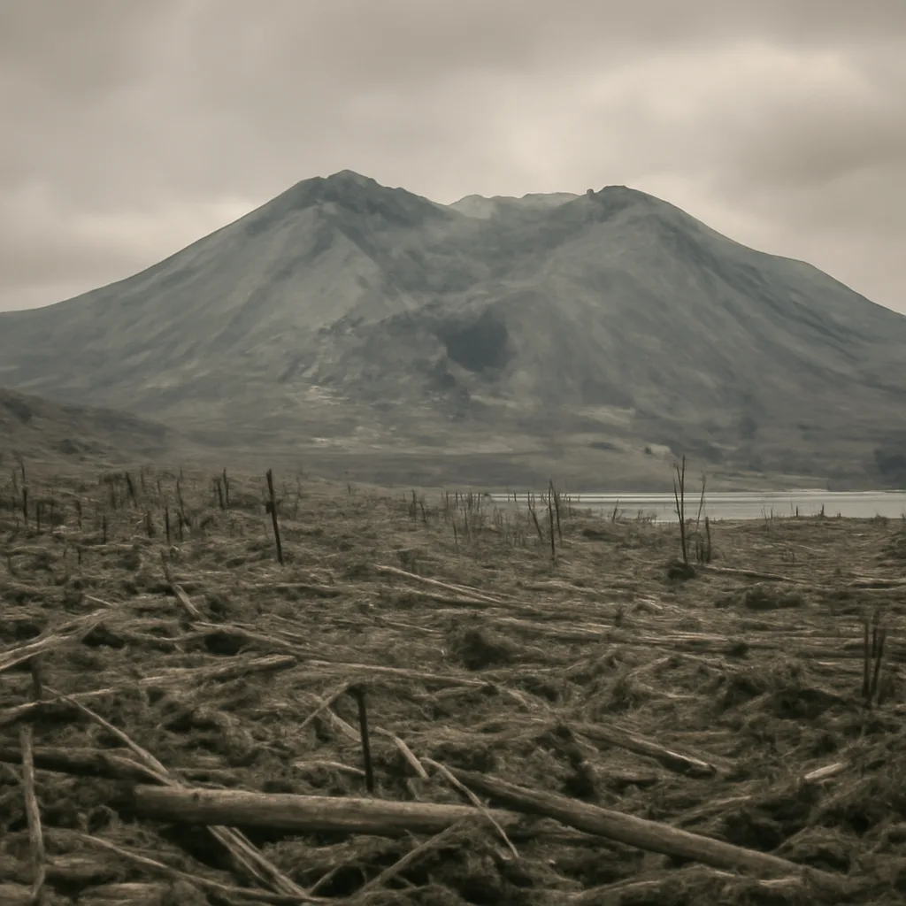
On the morning of May 18, 1980, Mount St. Helens, a stratovolcano in southwestern Washington state, produced one of the most significant volcanic eruptions in U.S. history. After weeks of seismic unrest and a large bulge on the volcano’s north flank, a magnitude 5.1 earthquake triggered a massive landslide followed immediately by a lateral blast. The eruption removed the upper 1,300 feet (about 400 meters) of the summit and sent a high-speed, hot debris and gas surge northward, devastating an area of about 230 square miles (600 square kilometers).
The lateral blast and ensuing pyroclastic flows leveled forests, buried river valleys in sediment, and destroyed bridges, rail lines, and highways. Ash plumes rose into the stratosphere and were carried by winds across the United States, causing ashfall in as many as 11 states and disrupting aviation and daily life. Lahars — volcanic mudflows — traveled down river systems, damming and inundating communities and altering landscapes.
Fifty-seven people were confirmed killed in the eruption. Victims included timber workers, residents, and scientists and journalists who had been in the area; some deaths were caused by the blast itself, others by burial under debris, suffocation from ash and gases, or drowning in floods and lahars. The Dead were concentrated in the most heavily impacted zones north of the volcano, including the Toutle River valley and areas around Spirit Lake, which was dramatically altered by the eruption and subsequent landslide deposits.
The eruption inflicted substantial economic damage: thousands of acres of timber were destroyed, infrastructure suffered heavy losses, and agriculture and transportation were disrupted. The U.S. Geological Survey (USGS) and other agencies undertook extensive monitoring and research in the eruption’s aftermath, improving scientific understanding of volcanic processes, hazards, and emergency response strategies. Policy changes and land management decisions followed; large tracts around the volcano were closed to development, and Mount St. Helens became a focus of volcanic monitoring and public education.
Environmental impacts were immediate and long-term. Entire ecosystems were stripped or buried in the blast zone, but the area has since become a natural laboratory for ecological recovery. Scientists have documented patterns of plant and animal recolonization, soil formation, and landscape evolution, providing valuable insights into primary succession and resilience after catastrophic disturbance.
The human response included search-and-rescue operations, emergency evacuations in surrounding communities, federal disaster assistance, and a national conversation about volcanic risk, preparedness, and land-use policy. Memorials and interpretive sites were later established, including the Mount St. Helens National Volcanic Monument, which preserves the blast zone for science, education, and recreation while restricting certain types of development.
Historical records and investigations have documented the lead-up to the eruption — an increase in seismicity beginning in March 1980 and the formation of a pronounced bulge on the volcano’s north flank — and have evaluated the decisions made by government agencies and individuals. While some debates have persisted about access and risk communication at the time, the eruption remains a pivotal event in U.S. geologic and emergency-management history, underscoring both the destructiveness of volcanic events and the importance of monitoring and preparedness.
The May 18, 1980, eruption of Mount St. Helens is remembered for its sudden violence, substantial loss of life, and enduring lessons for volcanology, emergency planning, and ecological recovery.